Water Intelligence · Sindh
The Blue Syndicate
Daily water accounting, accord compliance and satellite risk analysis for the Indus Basin.
See the seven tools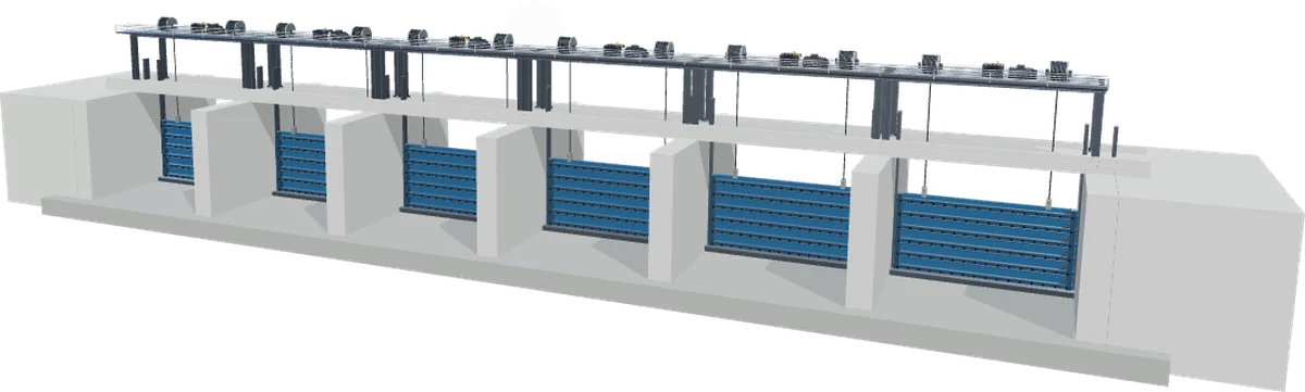


Daily water accounting, accord compliance and satellite risk analysis for the Indus Basin.
See the seven tools
Each reads from the same source — the Department's daily gauge registers, channel directories and line plans — so a figure on one is the same figure on all.
Daily water account tracker for Sindh's barrage network — Guddu, Sukkur and Kotri. Tracks inflows, outflows, diversions and accord compliance in real time.
Google Earth Engine–powered satellite monitoring for flood and embankment risk along the Kotri Barrage zone, using live remote sensing data.
Projects how Indus water should be regulated across Sindh's barrages — Taunsa → Guddu → Sukkur → Kotri — under the Accord and the Department's withdrawal decisions, then compares it against the actual gauges.
A live three-dimensional simulation of the entire Kotri Barrage — all 44 gates, both bank canals and the navigation lock — driven by a hydraulic engine calibrated on the Department's own gauge registers.
The Department's line plans, channel directories, O&M manuals and scheme reports, indexed against the whole irrigation network and searchable by text, division or channel.
 AI assistant
An irrigation expert you can simply ask. SALAR reads the registers, statements, manuals and line plans behind Sindh's canal network and answers in plain words — with every figure cited to the document and page it came from.
 Live map
Find & reach. Sindh's canal network drawn on the ground it waters — every main canal, branch, distributary, minor and drain, joined to the Department's channel register and to the day's water account at the barrages.
1 min 49 s · Urdu narration · sound on
Behind every figure on this platform sits a scanned register, a line plan or an O&M manual. SALAR has read them — and answers with the number and the page it came from.
The Blue Syndicate is a water data intelligence initiative serving Sindh's irrigation sector. We build tools that turn raw barrage and canal data into clear, actionable information for engineers, planners and administrators.
Our three-person team combines decades of on-ground irrigation experience, specialist expertise in water resources engineering and irrigation governance, and modern data science — bridging field practice and data to give decision-makers tools that are both technically rigorous and practically useful.
“United by Purpose. Driven by Flow.”


ME, Water Engineering & Management
Brings decades of field expertise in Sindh's irrigation network, barrage operations and water distribution management across the Indus Basin.

MSc, Business Analytics · Data & Technology Lead
Leads the data engineering and geospatial technology behind the platform, translating complex irrigation datasets into real-time intelligence tools.

ME, Water Engineering & Management
Brings field expertise in irrigation and river engineering, barrage operations and flood management across the Indus Basin, grounded in irrigation law and sustainable water governance.